Marine/Nautical Charts-Germany 102.0
Paid Version
Publisher Description
GPS Marine Charts App offers access to charts covering Germany (derived from BSH(Bundesamt für Seeschifffahrt und Hydrographie) data) with POI layers created from ENC charts. Only marine GPS app to have route assistance with Voice Prompts for marine navigation. It has route manager to create new boating routes or import existing GPX/KML routes. It supports Nautical Charts course up orientation.
* Voice Prompts for marine navigation (requires GPS )
-prompts when approaching a boating route marker
-Continous distance and ETA updates
-Alerts when sailing/boating off route
-Alerts when boating in wrong direction
*** For any question, contact support at gpsnauticalcharts.com / http://www.gpsnauticalcharts.com ***
*Route Editing/Creation
-Create routes from scratch
-Edit existing GPX/KML routes.
-Add custom description to any route point.
-Drop markers along route.
* Offline German charts. Charts are created from BSH ENC data.
-Visually draw area to download
-Textual search
-Catalog (North Sea, Baltic Sea)
-Charts reprojected for WGS84 datum
► Advanced NMEA Instrumentation
√AIS over TCP/UDP
√Wind speed, direction, temperature, depth, GPS over NMEA
*Seamless chart quilting of marine charts
*Distance Bearing tool
*Create custom way points
- Using GPS
-Select point on map
-Manually enter latitude & longitude coordinates
*Pan/Zoom/My Location
* Record Marine GPS tracks
* View tracks overlay
* Live track animation
* Track analytics/stats
* Export GPX tracks.
-Export to SDCard
-Share GPX trakcs with friends/View on Google earth.
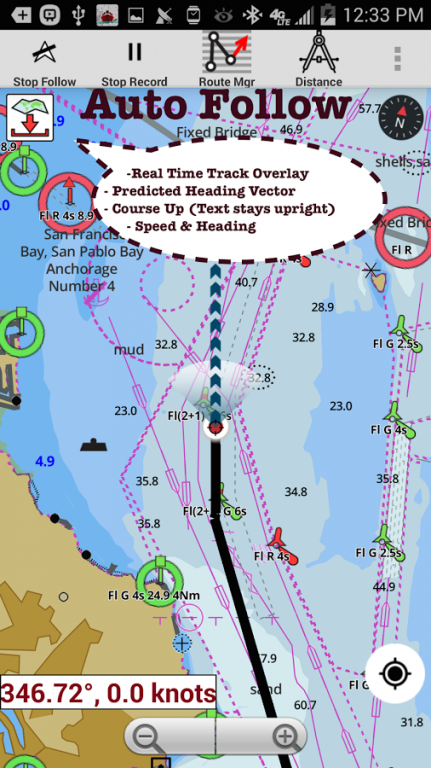
* Auto Follow Mode (Course up)
-Continuously updates boat's location on chart
- Adjustable update frequency
Sample Nautical Charts (please visit http://gpsnauticalcharts.com/main/folio-catalog-nautical-charts-app for complete list)
Lauterbach
Gager
Peenemuende
Vierow
Ruden
Kröslin
Wolgast
Peenestrom / Negenmark Rinne
Peenestrom / Der Strom
Uecker
Berndshof
List
Hoernum
Amrum
Dagebuell
Wyk
Schluettsiel
Helgoland
Buesum
Meldorf
Eider
Pellworm
Strucklahnungshoern
Husum
Dove Harle
Rendsburg
Cuxhaven
Brunsbuettel
Glueckstadt
Hamburg
Stadersand
Bremerhaven
Oldenburg
Elsfleth and Hunte Mouth
Brake
Bremen
Wilhelmshaven
Fischerbalje and Borkum
Norddeich
Norderney
Langeoog
Bensersiel
Emden
Ems Southern Part
Wendtorf
Kamp to Karnin
Eidersperrwerk
Toenning
Friedrichstadt
Baltic Sea
German Bight
Waters north of Kiel
Mecklenburger Bucht
Waters west of Ruegen
Waters east of Ruegen
Waters north of Helgoland
Waters south of Helgoland
Flensburger Foerde
Geltinger Bucht
Eckernfoerder Bucht
Schlei
Fehmarn Belt
Luebecker Bucht
Neustaedter Bucht
Wismar Approach
Rostock Approach
Saaler Bodden
Stralsund Approaches
Northern coastal waters of Ruegen
Sassnitz Approach
Greifswalder Bodden
Greifswald Approach
Usedom
North Frisian Islands northern part
North Frisian Islands southern part, Eider Approach
Helgoland Approach
Jade and Weser Approach
Elbe northern part
Kiel Canal
Kiel Canal Approach
Elbe southern part
Weser northern part
Weser southern part and Hunte
Jade
Juist to Spiekeroog
Ems Approach
Ems Northern Part
Dollart
Flensburg
Fahrensodde
Gluecksburg
Schausende
Langballigau
Gelting
Schleswig
Stexwig
Fleckeby
Missunde
Lindaunis
Arnis
Kappeln
Maasholm
Schleimuende and Olpenitz
Damp
Eckernfoerde
Kiel
Marina Lippe
Heiligenhafen
Burgstaaken
Grossenbrode
Marina Groemitz
Neustadt
Niendorf
Luebeck Harbours
Wismar
Timmendorf
Kirchdorf
Boltenhagen
Rostock
Kuehlungsborn
Stralsund
About Marine/Nautical Charts-Germany
Marine/Nautical Charts-Germany is a paid app for Android published in the Geography list of apps, part of Education.
The company that develops Marine/Nautical Charts-Germany is Gps Nautical Charts. The latest version released by its developer is 102.0.
To install Marine/Nautical Charts-Germany on your Android device, just click the green Continue To App button above to start the installation process. The app is listed on our website since 2016-12-19 and was downloaded 12 times. We have already checked if the download link is safe, however for your own protection we recommend that you scan the downloaded app with your antivirus. Your antivirus may detect the Marine/Nautical Charts-Germany as malware as malware if the download link to com.skiracer.nautical_astore_de is broken.
How to install Marine/Nautical Charts-Germany on your Android device:
- Click on the Continue To App button on our website. This will redirect you to Google Play.
- Once the Marine/Nautical Charts-Germany is shown in the Google Play listing of your Android device, you can start its download and installation. Tap on the Install button located below the search bar and to the right of the app icon.
- A pop-up window with the permissions required by Marine/Nautical Charts-Germany will be shown. Click on Accept to continue the process.
- Marine/Nautical Charts-Germany will be downloaded onto your device, displaying a progress. Once the download completes, the installation will start and you'll get a notification after the installation is finished.
